174-U2-6 UPPER COUNTY ROAD DP
Owner Information
CURTIN MICHAEL G TRUSTEE
29 THE OTHER ROAD
DENNISPORT, MA 02639


Property Details
174-U2-6 UPPER COUNTY ROAD DP is classified as a Residential Condominium (Flat/apt).
The primary structure on this property was built in 1971. There are 605ft2 of built area within this property. There is 605ft2 of residential/living space within this property. This property is listed as having 4 rooms.
174-U2-6 UPPER COUNTY ROAD DP is valued at $121,100. The land is valued at $0 and the structures are valued at $121,100.
The most recent deed for 174-U2-6 UPPER COUNTY ROAD DP is recorded at the local registrar in Book 30345, Page 350. 174-U2-6 UPPER COUNTY ROAD DP was last sold on Monday, March 13, 2017 for $0.
Assessment data from fiscal year 2022.
Flood Data
According to the FEMA National Flood Hazard Layer, this property does not appear to be in a flood zone. It may also be in an area not yet reviewed. Nonetheless, confirm this information prior to taking any action.
To view the flood hazards around this property, create a FEMA "Firmette" Map of the area around 174-U2-6 UPPER COUNTY ROAD DP.
Broadband Internet Providers
| Provider | Type | Bandwidth (mbps) | |
|---|---|---|---|
| GCI Communication Corp. | Satellite | 0 | 0 |
| Comcast | Cable | 1000 | 35 |
| Verizon New England Inc. | DSL | 5 | 0 |
| Viasat Inc | Satellite | 35 | 3 |
| VSAT Systems, LLC. | Satellite | 2 | 1 |
| HughesNet | Satellite | 25 | 3 |
Broadband service provider data from December 2020.
Adjacent Properties
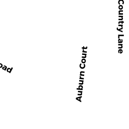
- 9 COUNTRY LANE DP
Single Family Residential owned by DARR JOHN A - 20 AUBURN COURT DP
Single Family Residential owned by DENNIS OYSTER COMP HLDNGS LLC - 21 COUNTRY LANE DP
Single Family Residential owned by MURPHY RICHARD ET UX - 6 CLIPPER LANE DP
Single Family Residential owned by SWEETSER PAUL E - 4 CLIPPER LANE DP
Single Family Residential owned by GAGNON JOSEPH R TRUSTEE - 2 CLIPPER LANE DP
Single Family Residential owned by MACK THOMAS - 158 UPPER COUNTY ROAD DP
Single Family Residential owned by PLATIKA CHRISTOPHER A